Cruising the Cornhusker State
Nebraska—While planning a tour of the western states, I realized all I’ve ever done in Nebraska is stop for gas off the interstate. And many people think that there isn’t much to see in the state. I thought, why not tour Nebraska and see what the state has to offer for the rider? So my friend John and I saddled up and hit the road
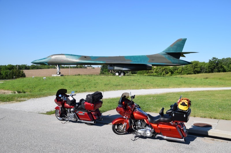
The first stop on our impromptu tour was Ashland, a small city midway between Omaha and Lincoln, and the home of the Strategic Air Command (SAC) Museum. The first thing we saw was a B-1 bomber and an ICBM missile. SAC carried the hammer against the Soviet Union during the cold war with nuclear weapons. The museum has a lot to offer with most of the aircraft and weapons of the cold war on display. You can walk under most of these aircraft and poke your head into the bomb bay or sit in the cockpit of a trainer.
After the museum we headed west on US-30 along the Platte River. Nebraska had lots of rain and the Platte was over its banks, with Nebraska as green as I have ever seen it. I-80, which comprised part of our route, is actually the route of the Oregon Trail from the migration west in the 1800s. No one knows how many unmarked graves are along the trail, but it is estimated there are hundreds from Indian attacks, disease and weather.
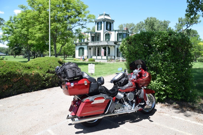
The next stop was Gothenburg where you can tour one of the original Pony Express stations. The station has been preserved in a park in the middle of town. Rolling west we stopped in North Platte, the home of Buffalo Bill Cody and the Golden Spike Tower. The Buffalo Bill Ranch State Historical Park is just a short distance off the main highway and you can tour Buffalo Bill’s home there. After stopping at the ranch we rode to the Golden Spike Tower to view the Union Pacific’s rail yard. The railyard is the largest in the world and has a mind-boggling 315 miles of track accommodating 115 trains a day.
From here we turned northwest on US-26 to Scotts Bluff. US-26 is a scenic ride along the North Platte River with views of Lake C. W. McConaughy. This is rolling country where you can see for miles. It was not long until Court House Rock and Jail House Rock came into view from miles away. As the pioneers made their way west they came across these rock formations that served as natural landmarks along the Oregon Trail.
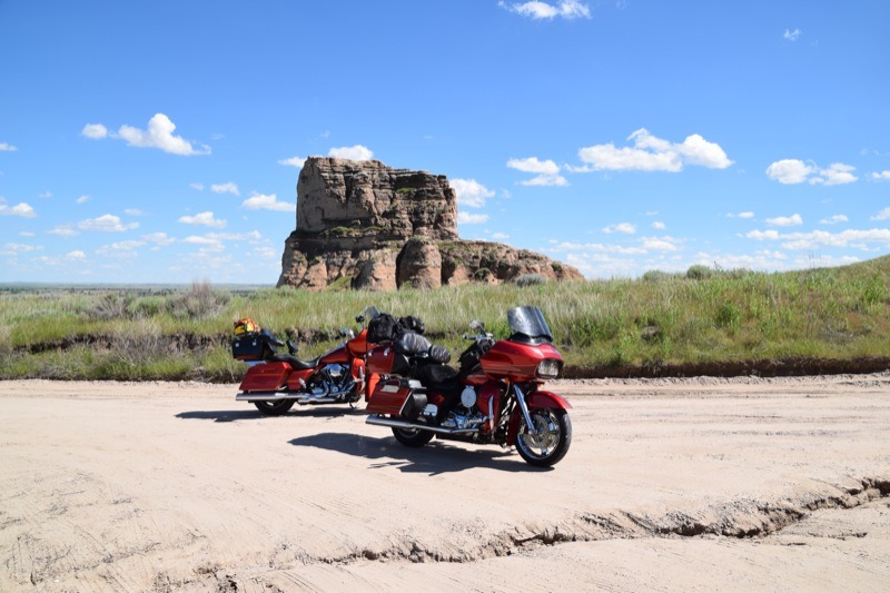
After stopping in the town of Bridgeport to fuel up, we rode 10 miles south to Court House Rock and Jail House Rock and the base of these rock formations. A turn-off takes you to the base of the formations, but after turning onto the road it was too late to turn back. The road was dirt, soft and rutted. With some effort we made it to both the base of Court House Rock and Jail House Rock. After some photos we managed to get back to pavement without mishap and continued north to Chimney Rock and on to Scotts Bluff for the night.
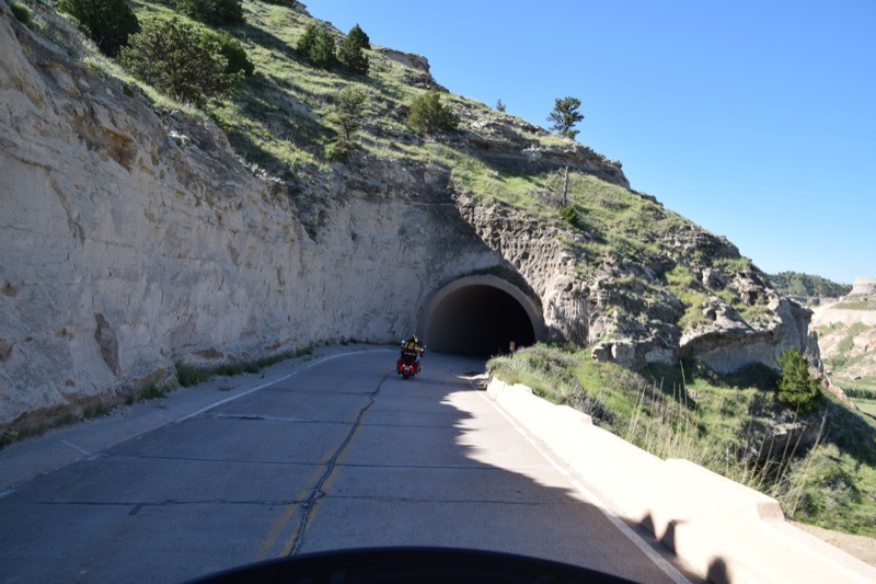
The next day we toured Scotts Bluff National Monument where you can ride to the top of the bluff through three tunnels with some nice curves that will make any rider smile. At the top you can see for miles in all directions.
Arriving in Crawford you will find a roadside stop with a plaque describing the history of Crawford and how the town was built around the railroad coming through in 1897. There is also a railroad caboose at the stop. Crawford was a booming town at the time with the railroad and Fort Robinson only three miles away. Soldiers at this outpost finally had a place to go and relax when Crawford sprung up.
Three miles east on US-20 we came to Fort Robinson and took a short tour. If you like western history do not miss it, with Crazy Horse, Red Cloud, Dull Knife, Buffalo Soldiers, German prisoners of war and K-9 Corps exhibits featured. In 1873 Fort Robinson became an outpost due to tensions between whites and the Lakota Nation. The fort grew over the years as the Buffalo Soldiers moved in and later the K-9 Corps and finally during World War II it was a German POW camp. The fort was decommissioned in 1952.
The area around the fort is very scenic with many bluffs dotting the skyline. From here John and I headed south on NE-2 and then NE-87 to Alliance. Traveling south on 87 we came upon one of the most interesting rest areas I had ever seen, the Alliance Rest Stop consisting of hay bales, an easy chair, a commode and Wi-Fi all out in the open.
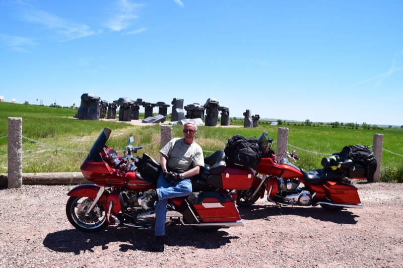
Two miles later we reached Carhenge, a kind-of replication of England’s Stonehenge. This replica was built by Jim Reinders in 1987 in honor of his late father. But Carhenge is built of automobiles, not stone. Thirty-eight cars were placed to assume the same positions as Stonehenge with the circle measuring 96 feet in diameter.

From here we turned north to Chadron and then east on US-20 passing the Museum of the Fur Trade. US-20 traverses the Sand Hills region of Nebraska. When I can ride an area where cattle and horses outnumber people by 1,000 to one, with little traffic, I’m happy. Along the way we passed through little towns with populations of 70 or 80 inhabitants. These towns are just holding on, but have lots of western history. Some, like Cody and Crookston, are almost ghost towns.
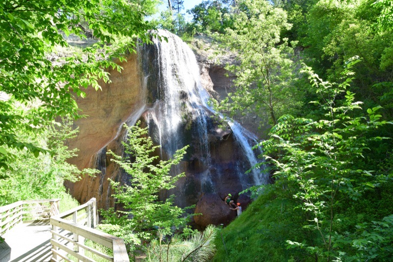
After enjoying the solitude of miles of the Sand Hills country we arrived in Valentine. Fifteen miles east of Valentine on NE-12 is Smith Falls State Park. The road into the park is hard pack gravel and in good condition. Smith Falls, on the Niobrara River, is the highest waterfalls in Nebraska. It was an easy half-mile walk to the base of the falls. If you are a camper you can camp right on the river and take a swim if you like.
From here we would be heading east and home. We both agreed that the Nebraska tour was a nice change of pace rather than just riding 450 miles of interstate on our way to somewhere else. The next time I head west I will get off the interstate and cross Nebraska on US-20 or NE-2. With little traffic and good pavement I will not lose any time and I can enjoy the scenery with many points of interest to explore along the way.
Sources
www.visitnebraska.com
www.visitnorthplatte.com
www.outdoornebraska.org
www.roadsideamerica.com
www.nebraskahistory.org


