
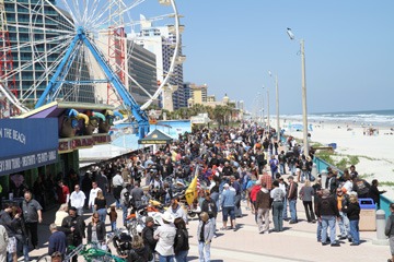
Motorcyclists consider Daytona Bike Week the kickoff of the riding season. Those in the northern climes envision riding along the beach in T-shirts and jeans, shrugging off the winter along with their cold-weather gear. In actuality, temperatures can vary quite widely and riders should prepare for whatever Mother Nature throws your way.
The average high for March is 76 degrees, and the average low is 54 degrees. However, back in 2002, a low of 36 was recorded and, as recently as 2006, the mercury dipped to 39 degrees. The reverse can be true, as well, with temperatures frequently reaching the high 80s; in March 2009, thermometers soared to 90 degrees. And let’s not forget about the tropical rainstorms that can hit quite suddenly in the middle of an otherwise perfect day.
With this wide swing of the weather pendulum, it’s best to pack riding gear for every atmospheric circumstance you might encounter. Bring a warm riding jacket and gloves (and a hat if you ride helmetless), and make sure you pack your rain gear. There’s no sense letting occasional cold or damp riding conditions ruin the party.
Ocala National Forest Ride

The Ocala National Forest encompasses over 380,000 acres and is less than 25 miles west of Daytona Beach. It is the southernmost forest in the continental United States and protects the world’s largest contiguous sand pine scrub forest, which includes more than 600 lakes, rivers and streams. Points of interest along this route include the Museum of Florida Art in Deland, Salt Springs and the nature-themed park in Silver Springs.Start in Deland, make the loop and ride back into Deland and the starting point.
Start at the corner of US 17/92 and Woodland Blvd, Deland (Museum of Florida Art is located at 600 N. Woodland Blvd)
1) Head north on US 17: 13.4 miles
2) Turn left onto State Hwy 40 (Black Bear Hwy) at Barberville: 14.4 miles
3) Right on State Hwy 19 (along shoreline of Lake George): 15.1 miles
4) Left on County Road 314: 18.1 miles
5) Left on State Hwy 40: 21.3 miles
6) Right on State Hwy 19: 14.5 miles
7) Left on County Road 42: 18.7 miles
8) Left on State Hwy 44: 5.3 miles
9) Left on North Florida Ave: 0.2 miles
10) Right on West Rich Ave: 0.1 miles
11) Left on US 17/92: 0.4 miles
Total = 121.5 miles
Looping Ormond and Tomoka Park
The Tomoka Basin lies just north of party central in Ormond Beach and presents a tranquil ride through forests and swamplands. The Loop is so highly prized that, in 2009, it was designated a National Scenic Byway. This route skirts along the Atlantic before turning inland and offers a corridor of forest canopies, sandy beaches and historic buildings, all at a laid-back, non-hurried pace. Northern right whales, humpback whales, dolphins, seasonal waterfowl and endangered turtles are all visible at selected sites during various times of the year.
Start in Ormond Beach at the intersection of Granada Blvd and Hwy A1A (OceanShore Blvd)
1) Head north on A1A past Bicentennial Park and through Ormond-By-The-Sea: 8.8 miles
2) Turn left (west) at High Bridge Road: 2.0 miles
3) At the stop sign, turn left onto Walter Boardman Lane: 1.2 miles
4) At the following stop sign, turn left on Old Dixie Hwy: 8.0 miles
Old Dixie Hwy turns into North Beach Street
5) Follow N. Beach St. along the Halifax River/Intracoastal Waterway: 3.4 miles
6) Left on Granada Blvd, cross the Granada Bridge to starting point at Hwy A1A: 1.0 miles
Total = 24.4 miles
7) To stretch out the ride a bit further, after crossing the Granada Bridge, at the foot of the bridge, turn left onto John Anderson Drive: 8.9 miles
8) Turn right at High Bridge Road: 2.0 miles
9) Turn right at A1A to starting point: 8.8 miles
Total = 44.1 miles
Ponce Inlet: Onward through the fog!
At the southernmost tip of the Daytona Beach peninsula is Ponce Inlet, a scenic fishing village with “Old Florida” charm. Built over 100 years ago, the Ponce de Leon Inlet Lighthouse is located here. It stands 175 feet tall and is open to the public during Bike Week. For those not interested in a hike that demanding, the nearby Suncruz Casino is available to test your gambling skills instead.

And if you’ve had your fill of turkey legs and tri-tip tacos from back on Main Street, a prime example of authentic Florida fare is on tap at the Down the Hatch Seafood Company. The ride south down Peninsula Drive skirts the Halifax River to its confluence with the Ponce de Leon Inlet, while the return trip up S. Atlantic Avenue (A1A) cruises past quaint beach homes and beautiful condos that hug the coastal beaches. Just be respectful when riding thru Ponce Inlet and watch your speed coming back up A1A, especially late at night.
Start in Daytona Beach at the intersection of Main Street and Peninsula Drive
1) Head south on Peninsula Dr. (along Intracoastal Waterway), crossing Silver Beach Avenue & Dunlawton Avenue: 11.68 miles (Lighthouse parking lot is on left)
2) Continue on S. Peninsula Dr.: 0.25 miles (Down the Hatch parking lot is on right)
3) Leaving Down the Hatch, take a right out of the parking lot onto S. Atlantic and through Lighthouse Point Park: 0.5 miles
4) Left on Robert A. Merrill Parkway: 1.0 miles (Robert A. Merrill turns into South Atlantic Ave.)
5) Take S. Atlantic north: 12.23 miles
6) Left on Main Street in Daytona to Peninsula Drive: 0.3 miles
Total = 25.96 miles
Coastal cruising
While many heading north from Bike Week central endure the grind of Interstate 95, A1A is a two-lane coastal ramble that was Florida’s main traffic artery well before that featureless concrete thoroughfare. Also called the Historic Coastal Byway, A1A North bisects colorful beaches and many examples of “Old Florida” charm.
Not-to-be-missed establishments in Flagler Beach include Grampa’s Uke Joint (with Hawaiian shirts and painted ukuleles) and the Salty Dog (where the locals eat; a great place to grab a sandwich and beer while the bike cools down). And the historic Fort Matanzas National Monument is right up the Byway near Summer Haven and is a great place to stretch your legs and grab some photos. The return route cuts inland and takes State Highway 17, a designated Florida Scenic Route that skirts the east side of Lake George.
Begin in Daytona Beach at the intersection of Main & A1A (N. Atlantic)
1) Head north on A1A through Flagler Beach and Palm Coast to Crescent Beach: 42.4 miles
2) Turn left (west) on State Hwy 206: 14.5 miles
3) Turn left on State Hwy 207: 9.5 miles
4) At the intersection of US 17 & State Hwy 100, take US 17 left: 40.8 miles
5) Left on State Hwy 40: 24.8 miles
6) Right on A1A to starting point: 4.9 miles
Total = 136.9 miles


