Heading up Down East
A maritime meander
EASTERN MAINE—It’s 10:00 in the morning and already the heat wave is pushing for a new record. Traffic is at a crawl and I’m watching my oil temperature gauge like a hawk while I lurch up Route 1A in a series of first-gear bursts punctuated by bouts of idling. From Kittery, Maine, to Eastport is only 225 miles as the crow flies, but between them lies some 3,500 miles of coastline. The most southern 35 miles of this coast contain 90 percent of the sand beaches and on a given peak summer weekend, millions of New Englanders come to stake out their blanket-size claims on the Maine Riviera. My first destination lies just beyond York Beach.
This state has 63 lighthouses, more than any other in the country. However, only 10 of these are accessible by motorcycle and the two most famous stand at opposite ends of the Maine coastline. My first stop is at Nubble Light.
The official name for this lighthouse is Cape Neddick Light, but it sits on a tiny rock island that’s called The Nubble, so everyone calls it Nubble Light. Riders are pouring into Sohier Park where a third of the pavement is taken up by very hot motorcycles, clicking and snapping as their engines cool.
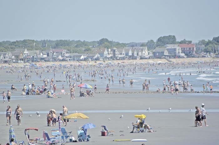
U.S. Route 1 is a strip development filled with fast food, pseudo lobster pounds, hotels and you name it. I attempt to be clever and take Shore Road to Ogunquit, but get behind a line of traffic that moves slower than the posted speed limit of 35 mph. At least it’s a scenic route. Ogunquit has an absolutely gorgeous 3.5-mile long beach and this community of just over 1,200 residents will host three-quarters of a million visitors on a weekend like this one. Haven’t made a hotel reservation? Well, keep on moving.
I was planning to stop at the auto museum in Wells or the Seashore Trolley Museum in Kennebunk, but I’m simply running too far behind. I am glad I chose to wear a ballistic nylon jacket instead of my leathers as the temperature reads 98 degrees on this day—in the shade.
Being a glutton for punishment I roll down to Old Orchard Beach. I remember there being motorcycle parking spaces here during the late 1960s—the first place I ever found them. They’re still here, but each of them—in fact, all parking spaces—are filled. A cop who is directing traffic allows me to park in a loading zone for 20 minutes so I can score a slice of pizza and bottle of water. Maine is a biker-friendly state.
I blow through Portland on I-295 and exit onto Route 1 in Yarmouth to stop at DeLorme headquarters where Eartha, the world’s largest rotating globe, is on display, but I’m not stopping to get my bearings, merely to use a clean bathroom and pick up a rechargeable battery for my GPS unit.
I easily make it through Freeport, home to L.L. Bean. Open 24/7/365, there are no locks on the door of their flagship store. Of course they’re not the only major retailer in town so traffic—both vehicular and pedestrian—can be a bit stupid at times. Not so at 6:00 p.m. on a Sunday.
From Brunswick I ride south down the Harpswell Peninsula, cross to Orr’s Island, and then over the only cribstone bridge in the world to reach Bailey Island and the motel with this same name. It’s gorgeous here. I must confess that I really don’t like lobster, so instead of going to Cook’s (a real lobster pound with a restaurant) I go to BIGS (Bailey Island General Store). They make me a BLT, while I purchase a couple bottles of Lobster Ale—a close enough substitute.
Someone has calculated that all the ships of all the navies in the world could anchor in the deep inlets of this coast at the same time. One of these long, deep inlets meets the Kennebec River and this is where Bath, the City of Ships, is located. It’s 13 miles from Bailey Island back to U.S. Route 1 and then only five miles east to Bath. During the 18th and 19th centuries this town was famous for launching wooden ships. The Bath Iron Works (BIW) began building ships in 1888 and during World War II they built more destroyers than all the shipyards in Japan combined. Today they’re still building navy ships, although these are now guided-missile destroyers. The history of wooden-ship building is preserved—and taught—at the Maine Maritime Museum. One encourages photography; one does not. Yet both offer tours and are in full view on the river.
The mid-coast is a succession of peninsulas and inlets. Some, like Boothbay and Linekin Neck, I’m exploring for the first time. Others, such as Pemaquid Point, are as familiar as old friends. A few must be left for other trips.
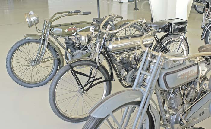
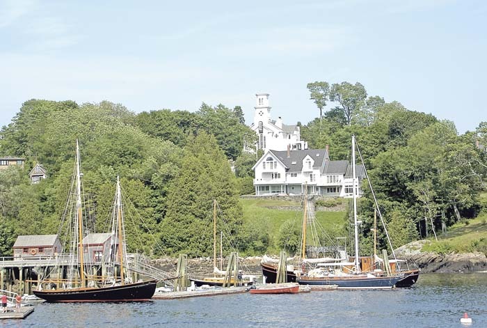
As usual, I stop at the Maine State Prison Showroom. This unique retail store features the work of inmates at the prison that are enrolled in the Industries Program. Some amazing woodworking art comes out of this program and the current centerpiece is a full-size chopper ridden by King Neptune and a very sexy mermaid. The Owl’s Head Transportation Museum is another favorite of mine, although today I only stop to say hello. I also never fail to pay a visit to both Rockport and Camden harbors to see what windjammers or tall ships are moored there.
Tonight I’m staying at the Belfast Comfort Inn, which is next door to the Maine Coast Welcome Center owned by my friends Jim and Patti. It’s a good thing; the machine requires some repair work before I can continue my journey.
After a morning of wrenching, I’m off for a whirlwind tour of the Blue Hill Peninsula and Deer Isle after crossing the spectacular Penobscot Narrows Bridge. After five hours and 124 miles, I arrive at the Castlemaine Inn in Bar Harbor. Obviously I’m not going “as the crow flies” since it would have taken less than an hour to reach Bar Harbor by the direct route.
Acadia was the first national park established east of the Rocky Mountains and is one of the most popular in the nation. Its carriage roads are closed to motor vehicles, but the Loop Road was designed by Frederick Law Olmstead Jr.—who also designed Central Park in New York City—for automobiles. I start out at 6:00 a.m. and have the road almost to myself. The landscape is stunning in the early light and I climb to the summit of Cadillac Mount, the highest peak on the Atlantic coast and the first place in the U.S. to see the sunrise.
After breakfast I set out to explore the rest of Mt. Desert Island, the sixth largest island on the coast of the lower 48 states. Sargent Drive, along the eastern shore of the only fjord on the Atlantic coast, is as stunning as the Loop Road and the Seal Cove Auto Museum turns out to be a treasure trove. A storm is moving in and I call it a day, booking into the Seawall Motel far from the crowds on the eastern side of the island.
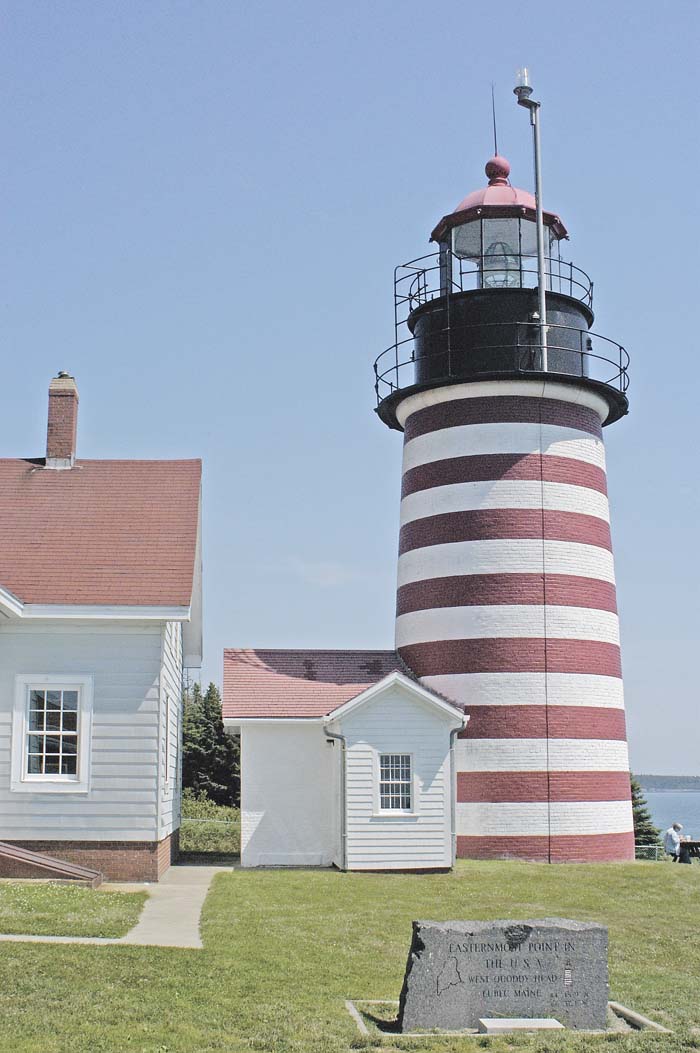
Today there will be fewer stops as I cross the region known as Down East. In the era of sail, ships would leave port in Newport or Boston and travel downwind (with the wind) to go east to Maine, hence “down east.” My destination is Lubec and the famous lighthouse at West Quoddy Head, the easternmost point in the U.S. With its horizontal bands of red and white this is the archetypal image of what a lighthouse should look like.
Lubec is the easternmost town, but Eastport the easternmost city in our country—a legal nuance since they’re both the same size. Here the famous Fundy tides rise and fall 20 feet, twice a day, and piers are built accordingly. The tides also form the largest whirlpool in the Western Hemisphere, the Old Sow, within sight of the ferry dock.
I’ve ridden the Maine coast, but this state is as big as the rest of New England. I now have my eye on the northeast corner of the U.S. in Madawaska and the only park dedicated to long-distance motorcycle touring. But tomorrow is another story.